Hinterland Demo (Hinterland How's How?)
Hinterland How-To
The nature of a one-sheet pamphlet is that details and examples fall by the wayside. I hope that this annotated demonstration will help clarify some of the arcane and opaque methods presented in HINTERLAND. The ordered/unordered list interface on here has made copy-pasting my draft over a nightmare. Please excuse the disarray and inconsistent formatting.
- Bioclimatic Zone
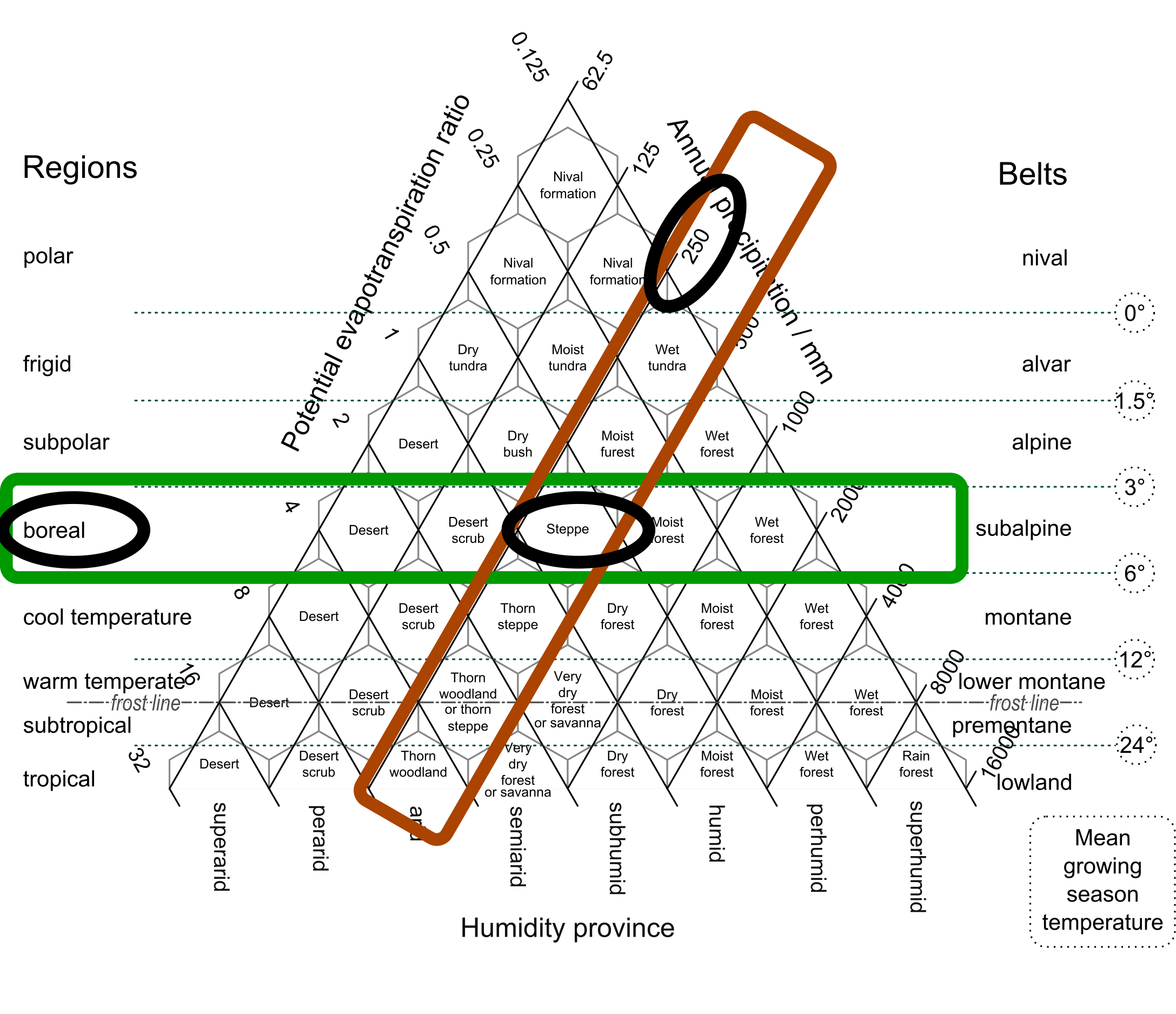
The bioclimatic zone system is based on Hodridge Life Zones (Holdridge 1947). This ternary plot presents “life zones” (geographic areas with common climate and biology) organized based on temperature or elevation band (latitude and altitude have similar effects on temperature) and humidity, either expressed based on rainfall or evapotranspiration (how much moisture recycles from the ground and vegetation into the atmosphere). In a TTRPG context, this acts as a shorthand in that it is a quick base summary of “nature” for your region.
To Establish the bioclimatic zone:
- Roll 1D8 and consult the “Latitude Regions” column in the table.
- In my example set-up I have rolled a 5: “boreal”.
- This is a cold latitude roughly between 50-55° N and 65-70° N; the northern margin of the treeline. Much of Canada, Russia, and Scandinavia is a boreal zone.
- Roll 1D8 and consult the “Annual Precipitation” column.
- I rolled a 3: 250mm annual precipitation.
- This aligns with the “Steppe” cell.
- Boreal Steppe is a cold, relatively climate, with sparse evergreen forests and grass/shrubland. It is often a transition zone between the prairies and the boreal forest.
- Roll 3D6 and consult the “Altitude Belt” column.
- I rolled a 7: lowland.
- This means that “boreal steppe” is my base regional climate.
- My characters can expect long, cold, snowy winters, short summers, and wilds populated with abundant deer, frequent bear, moose, and wolves, and occasional wolverines, and large cats.
- Topography and Terrain
To set elevation zones:
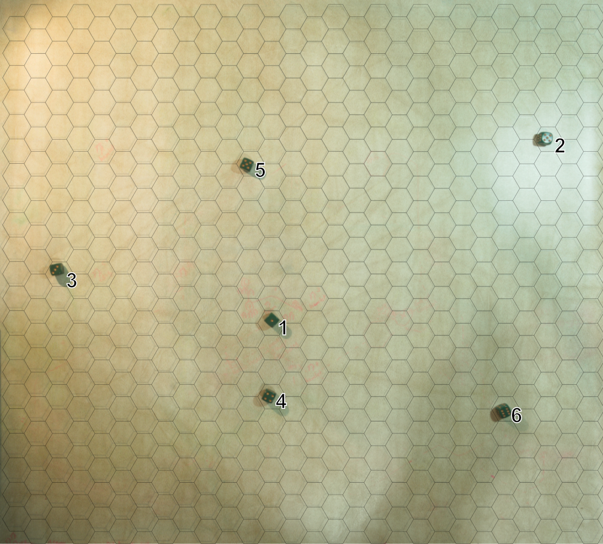
- Toss N D6 onto a map space
- I use a hex-grid dry-erase mat.
- I tossed 6D6; results: 1,2,3,4,5,6
- Draw a polygon around each D6
- The value of each die indicates the radius of the polygon in hexes.
- Adjoining and overlapping polygons are merged.
- The polygons will be one altitude belt higher than my base zone, following the same annual precipitation column.
- Since my base zone is boreal steppe; the highlands will be premontane moist forest with subpolar mean growing season temperature.
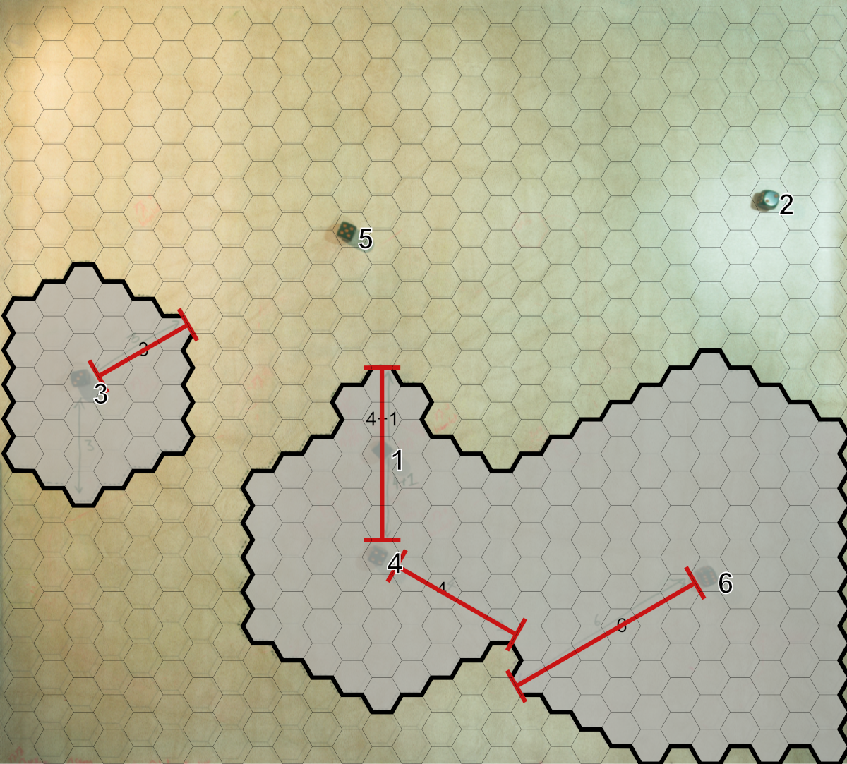
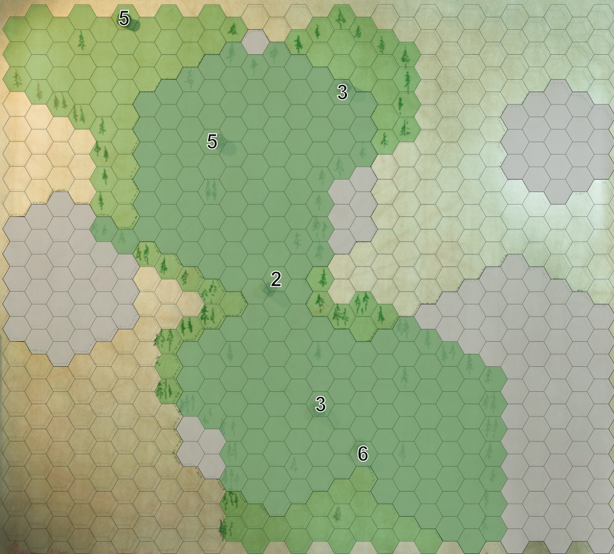
- Repeat this process to add other zones to your map. I decided to add vegetation variety by adding zones with higher moisture values. I did this by throwing 6D6 again, marking the perimeters, and then consulting the Holdridge plot once more, but one shift down on the “potential evapotranspiration ratio” columns.
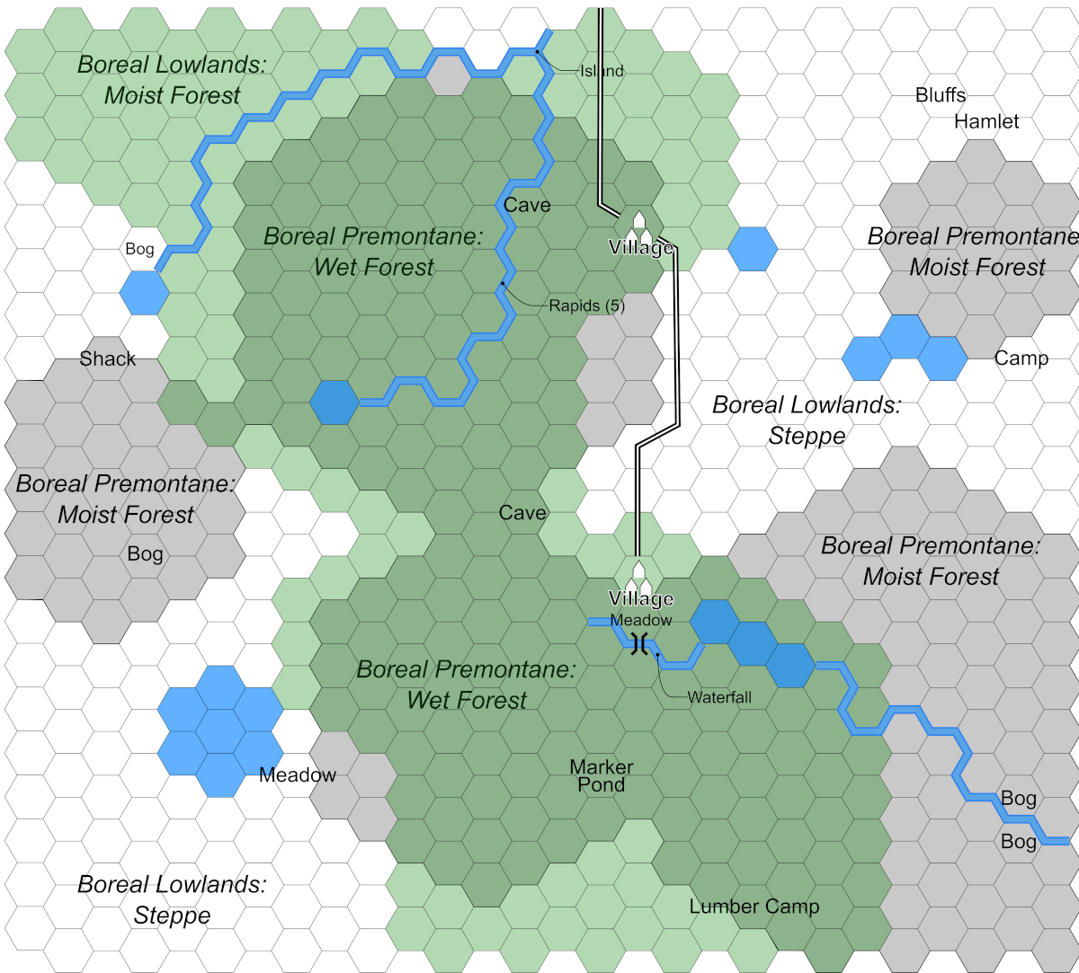
- My new lowland zones are boreal: moist forest; the new highland zones are premontane wet forest with subpolar mean growing season temperature.
- This is great for the mood and setting of my game: my steppelands are divided by a dark forest of black spruce, with boggy ground, muskeg, and all the horrors that come with that.
- Point Topography and Terrain
I decided that my altitude belt was adequate so I didn’t add more hills, but the boreal wilds are filled with lakes so I tossed some in (literally!). I didn’t want to go overboard, however, so I decided to use 6D6 again.
Lakes:
Toss 6D6 on the map and mark the locations.
Refer to the point topography table for lake shape.
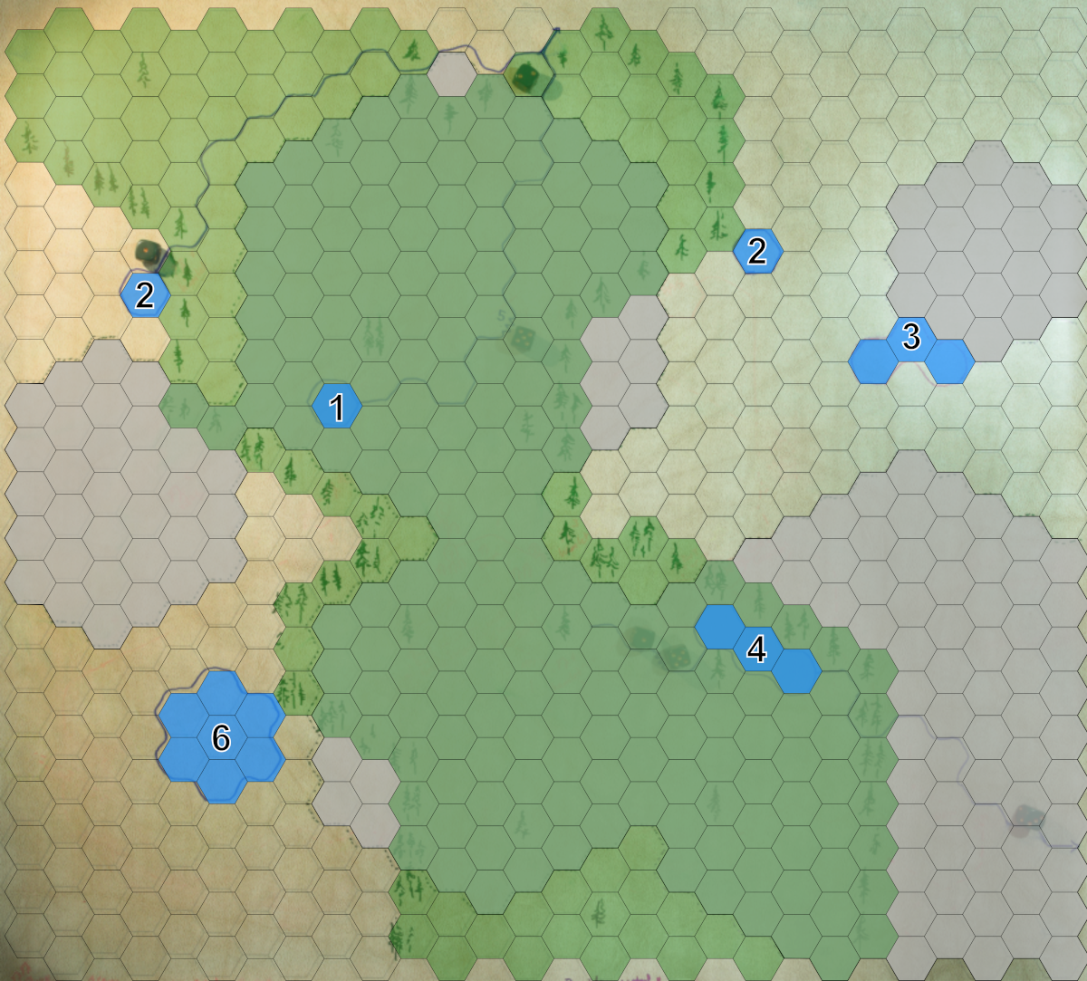
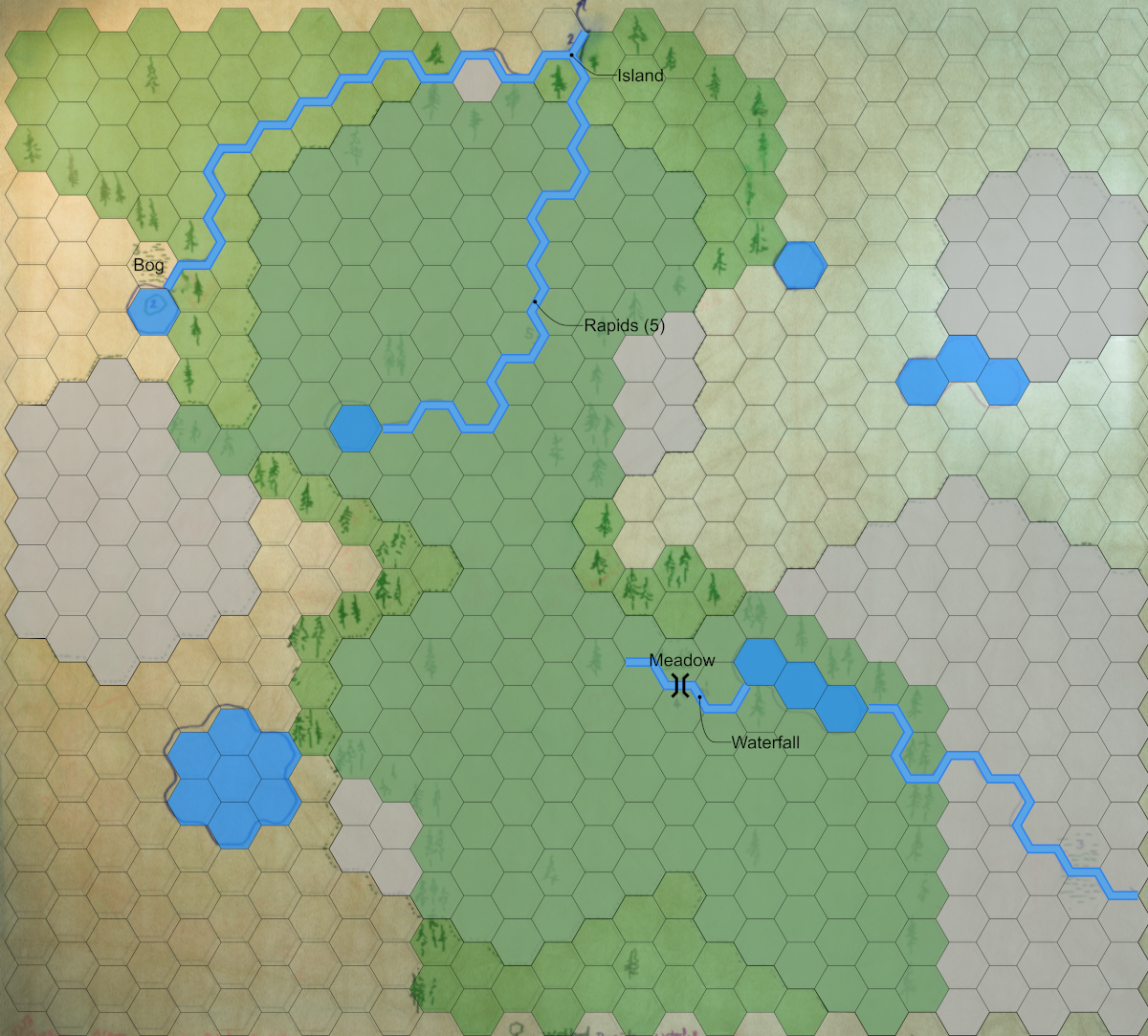
I also threw 6D6 for rivers. (The dice are just visible under the semi-opaque vector overlay in the image above.)
- Throw another handful of dice on the map.
- Mark the results.
- Connect the dots!
- These lines indicate rivers that are generally navigable; minor streams are not marked on the map.
- Rivers are marked along hex boundaries because even if you are paddling down a river, to explore a given hex you presumably land your craft on one or the other bank!
- Consider the topography: rivers flow down from heights of elevation, so unless you carve a canyon they won’t bisect a ridge or plateau.
- I decided to have three rivers that originate as lake outflows (the lakes are presumably fed by streams and seepage).
- Consult the “Riverine Features” column under “Landmarks and Features” for the features that correspond to your dice rolls.
Landmarks and Features
One thing to consider with all of the features placed using HINTERLAND: this is a map of known features. There is still a lot of “empty” terrain between these points that holds much more to discover!
- As usual, toss a handful of D6 on the map for natural features.
- Consult the “Natural” features column.
- Repeat for cultural features.
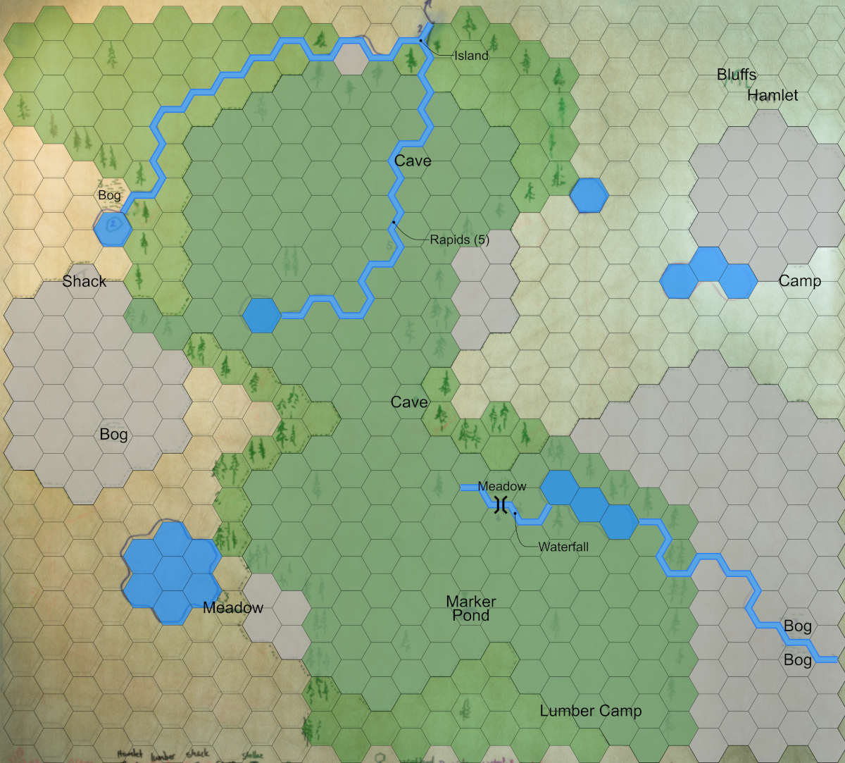
I skipped the cultural features roll; my characters will discover these sites in-game. The “marker” (a standing stone/megalith) in the south of the map is the result of a roll of 6 in the Natural landmarks: “roll again (I got a pond) and add a cultural landmark”.
Small Habitations
These are the lonely cabins, isolated prospector’s shacks, hunting campsites, and small clusters of huts where only a few people live.
- Toss 4D6 and consult the “Habitation” column for the results.
- I decided to add four habitation sites; it’s a small map and I want it to feel at least somewhat remote and unpopulated.
- My results: a campsite, a shack, a hamlet, and a lumber camp.
- Mark the results on the map.
Villages
These are the larger habitations where one might find a tavern, blacksmith, healer, local guide, etc. They are not towns by any stretch of the imagination. These are the “end of the road” places that exist as outposts from which people venture into the hinterland (hence the name of the system!) to hunt, trap, mine, log, and generally explore.
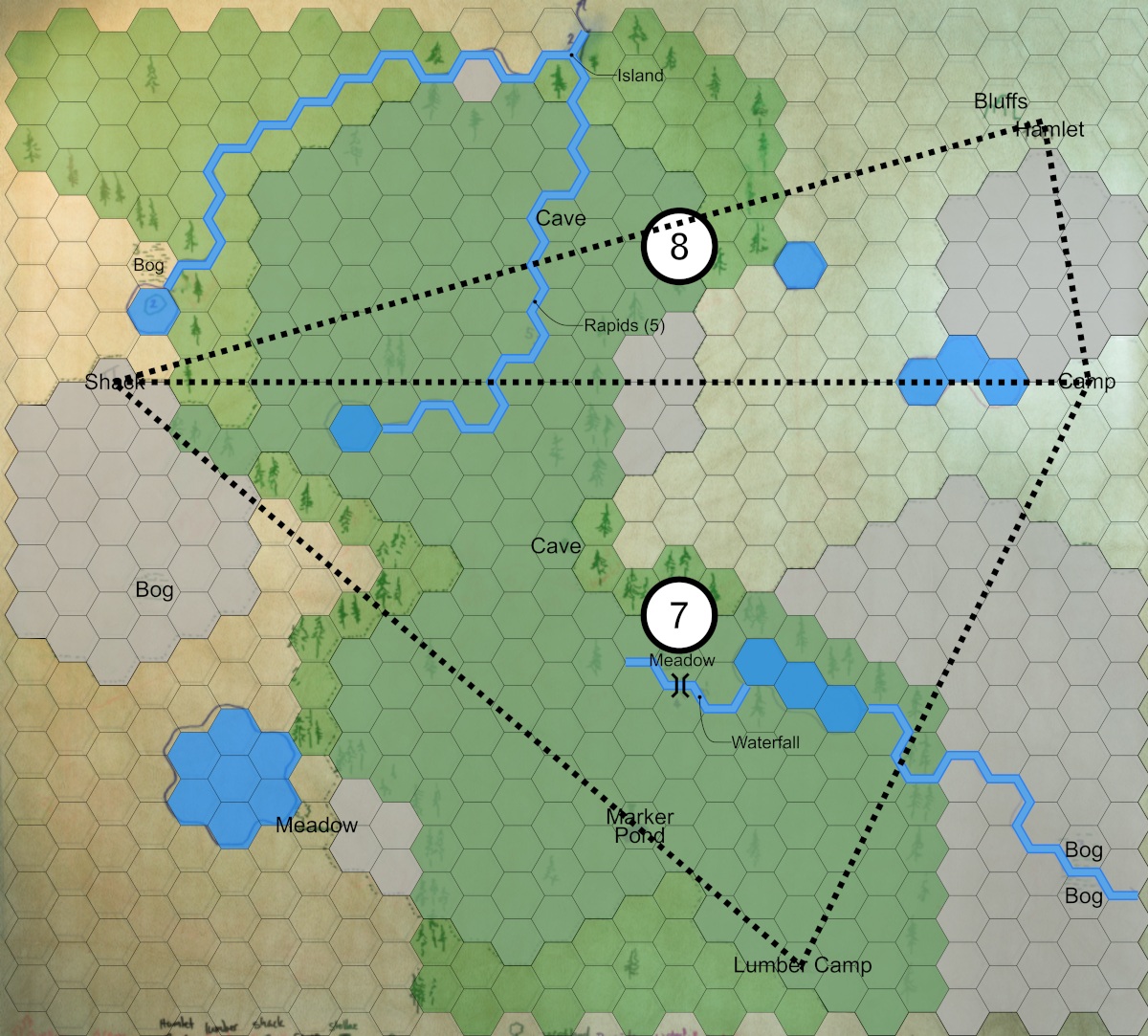
- Imagine a set of triangles connecting the dice locations for the small habitation sites.
- Mark a point roughly near the centre of each triangle. That is a village.
- Number that point based on the sum of the dice results.
- Compare that number to the Village Description table.
- My villages are both “ordinary villages”.
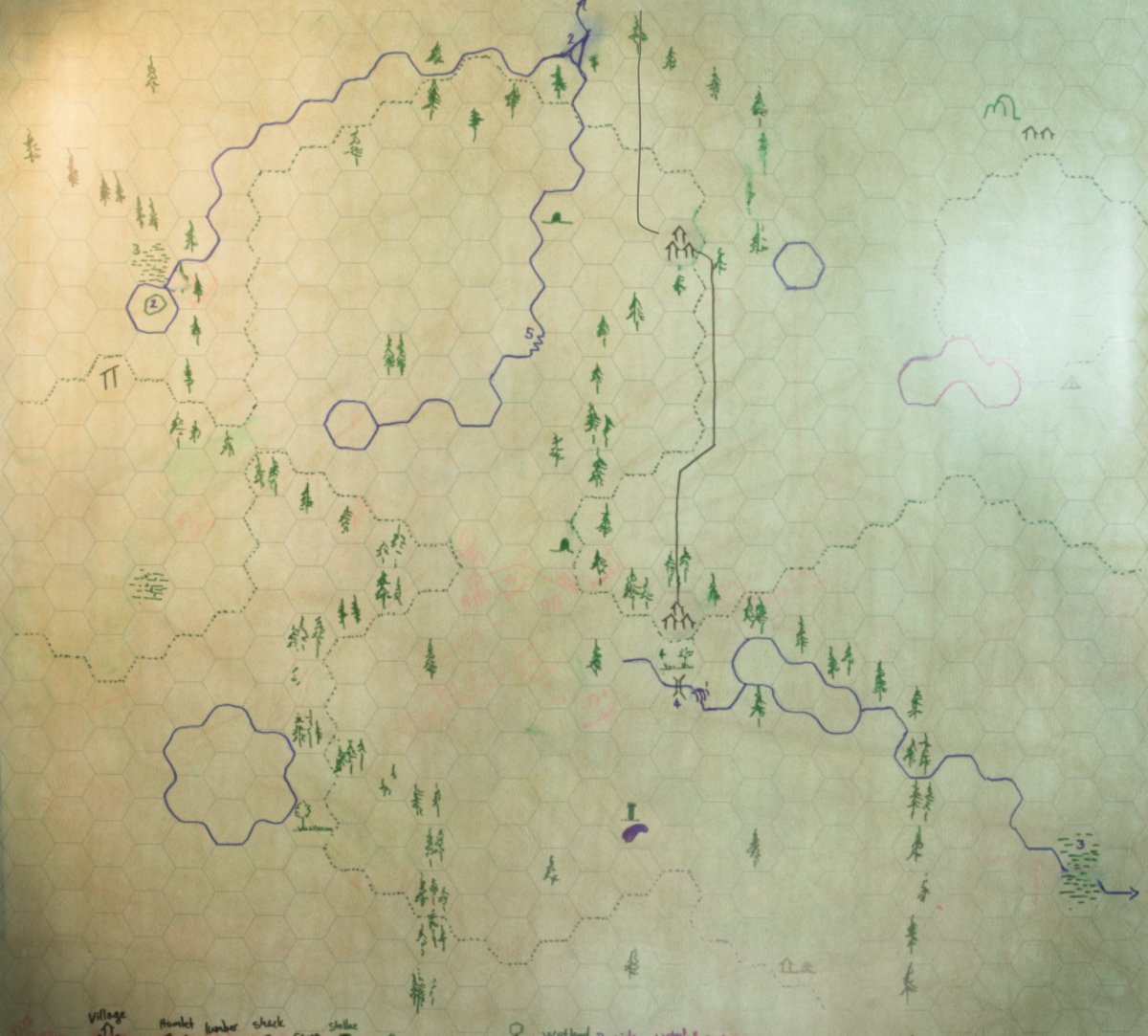
- If my caffeine levels were adequate I would have “nudged” the village sites one or two hexes over so they would each be on a river or lake—real settlements are generally situated in sensible places where there is abundant fresh water and natural travel corridors. But for this demo I have left them in place... just not quite in the right spot. Perhaps this will affect the attitudes of the NPC denizens of those settlements. Or I’ll erase them on my map and shift them each over. I just don’t want to generate all these images anew.
The end result is a pretty solid landscape to go adventuring in. The environment is interesting—a mix of open steppe, sparse and dense forest, with highlands and lower swampy ground. The habitations and villages are spread out enough that my PCs will feel isolated, and discoveries will feel “real” (with so few people in such a harsh environment it’s possible that the ruined temple has remained lost for millennia!). The lakes and rivers offer alternative travel corridors from just slogging through the brush. It all feels suitable “real”, at least for now. Final images below.
Files
Get Hinterland
Hinterland
Dice-based map builder for TTRPG adventures
| Status | In development |
| Category | Physical game |
| Author | nwaber |
| Tags | Hexcrawl, mapbuilder, One-page, OSR, Solo RPG, Tabletop role-playing game |
Leave a comment
Log in with itch.io to leave a comment.